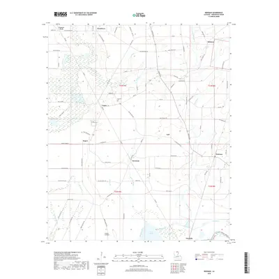
2018 Map of Beekman
USGS Topo · Published 2018About this map
Beekman and the surrounding Morehouse Parish countryside are defined by a complex network of slow-moving waterways and low-lying basins. The southern portion of this landscape is dominated by the Bussy Brake and Ward Brake reservoirs, while the eastern edge follows the winding course of Bayou Bartholomew. These wetlands are interspersed with higher ground such as Prairie de Butte, where early settlement patterns are visible through family-named landmarks and old transport routes. Small communities like Stevenson, Vaughn, and Wardville are connected by a web of local roads and trails, including the descriptive Long Lonesome Rd and White Line Rd. Genealogists will find the Stevenson Cem noted near the center of the survey area, reflecting the long-standing rural neighborhoods that have persisted alongside the region's managed waterways and agricultural tracts.
Find a feature on this map
93 named features on this map. Tap any name to fly to it.
Don’t see what you’re looking for? This feature index may not catch every label — zoom into the map to look around manually.
Map Details
Editions of this 2018 Beekman Map
This is the sole edition of this map. No revisions or reprints were ever made.
Other maps of this area

1934 · Felsenthal
USGS Topo · 1:62,500

1935 · Naff
USGS Topo · 1:62,500

1935 · Haile
USGS Topo · 1:62,500

1937 · Felsenthal
USGS Topo · 1:62,500

1938 · Felsenthal
USGS Topo · 1:62,500

1939 · Felsenthal
USGS Topo · 1:62,500

1953 · Greenwood
USGS Topo · 1:250,000

1953 · El Dorado
USGS Topo · 1:250,000

1955 · Jackson
USGS Topo · 1:250,000

1955 · Shreveport
USGS Topo · 1:250,000