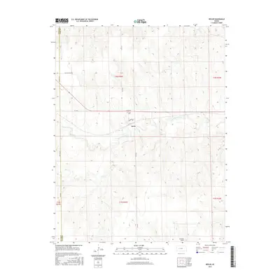
2015 Map of Beeler
USGS Topo · Published 2015About this map
Beeler serves as the central point of this West-Central Kansas landscape, situated where the high plains meet the drainage of the S Fork Walnut Cr. The settlement is small, defined by a grid including Broadway and proximity to the Beeler Cem. The surrounding terrain in Ness and Lane counties is marked by the gradual erosion patterns of Darr Cr and the aptly named Guzzlers Gulch. Transportation routes follow the township and range lines typical of the region, though the naming of Old Blue Trail Rd suggests a connection to older western transit corridors that predated modern highway systems. This 2015 survey illustrates the persistent agricultural and ranching layout of the area, where watercourses like the S Fork Walnut Cr remain the primary geographical features influencing the placement of roads and homesteads.
Find a feature on this map
16 named features on this map. Tap any name to fly to it.
Don’t see what you’re looking for? This feature index may not catch every label — zoom into the map to look around manually.
Map Details
Editions of this 2015 Beeler Map
This is the sole edition of this map. No revisions or reprints were ever made.
Other maps of this area

1955 · Scott City
USGS Topo · 1:250,000

1958 · Scott City
USGS Topo · 1:250,000

1965 · Beeler
USGS Topo · 1:24,000

1965 · Utica SW
USGS Topo · 1:24,000

1966 · Laird
USGS Topo · 1:24,000

1966 · Utica SE
USGS Topo · 1:24,000
1974 · Beeler SE
USGS Topo · 1:24,000

1974 · Alamota
USGS Topo · 1:24,000

1974 · Beeler SW
USGS Topo · 1:24,000

1974 · Dighton SE
USGS Topo · 1:24,000