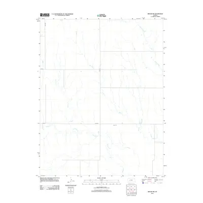
2012 Map of Beeler SW
USGS Topo · Published 2012About this map
The quiet rural landscape of Finney County is defined by a dendritic network of seasonal drainages including Hackberry Cr, Plum Cr, and Spring Cr. This western Kansas terrain, surveyed in the early 21st century, remains largely open and agricultural, with its section-line road system established by routes such as Co RD 50 and Road 523. A significant point for local history is the Buda Cem, which sits along the township border as a lasting marker of the area's early settlement era. The map also captures the boundary between Lane and Ness counties at Lane-Ness, while Guzzlers Gulch cuts through the northeast, illustrating the subtle but essential topography that governs water flow in this high plains region.
Find a feature on this map
11 named features on this map. Tap any name to fly to it.
Don’t see what you’re looking for? This feature index may not catch every label — zoom into the map to look around manually.
Map Details
Editions of this 2012 Beeler SW Map
This is the sole edition of this map. No revisions or reprints were ever made.
Other maps of this area

1955 · Scott City
USGS Topo · 1:250,000

1958 · Scott City
USGS Topo · 1:250,000

1965 · Beeler
USGS Topo · 1:24,000

1966 · Laird
USGS Topo · 1:24,000
1974 · Horse Thief Canyon NE
USGS Topo · 1:24,000
1974 · Beeler SE
USGS Topo · 1:24,000

1974 · Alamota
USGS Topo · 1:24,000

1974 · Hay Canyon
USGS Topo · 1:24,000

1974 · Beeler SW
USGS Topo · 1:24,000

1974 · Dighton SE
USGS Topo · 1:24,000