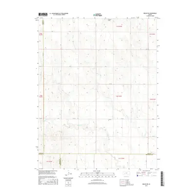
2015 Map of Beeler SW
USGS Topo · Published 2015About this map
Buda Cem sits as a lonely marker of early settlement in this rural expanse where four Kansas counties meet. Located near the intersection of Lane, Ness, Finney, and Hodgeman, the landscape is defined by the headwaters of several drainages, including Hackberry Cr and the winding course of Plum Cr. The area's agricultural character is underscored by a strictly organized grid of rural roads, such as Co RD 523 and W 40 RD, which navigate the subtle draws of Spring Cr and the curiously named Guzzlers Gulch. This 2015 survey illustrates the persistent isolation of the High Plains, where the original land partitions and small family cemeteries like Buda Cem remain the primary evidence of historical residency amidst the vast acreage of southwestern Kansas.
Find a feature on this map
21 named features on this map. Tap any name to fly to it.
Don’t see what you’re looking for? This feature index may not catch every label — zoom into the map to look around manually.
Map Details
Editions of this 2015 Beeler SW Map
This is the sole edition of this map. No revisions or reprints were ever made.
Other maps of this area

1955 · Scott City
USGS Topo · 1:250,000

1958 · Scott City
USGS Topo · 1:250,000

1965 · Beeler
USGS Topo · 1:24,000

1966 · Laird
USGS Topo · 1:24,000
1974 · Horse Thief Canyon NE
USGS Topo · 1:24,000
1974 · Beeler SE
USGS Topo · 1:24,000

1974 · Alamota
USGS Topo · 1:24,000

1974 · Hay Canyon
USGS Topo · 1:24,000

1974 · Beeler SW
USGS Topo · 1:24,000

1974 · Dighton SE
USGS Topo · 1:24,000