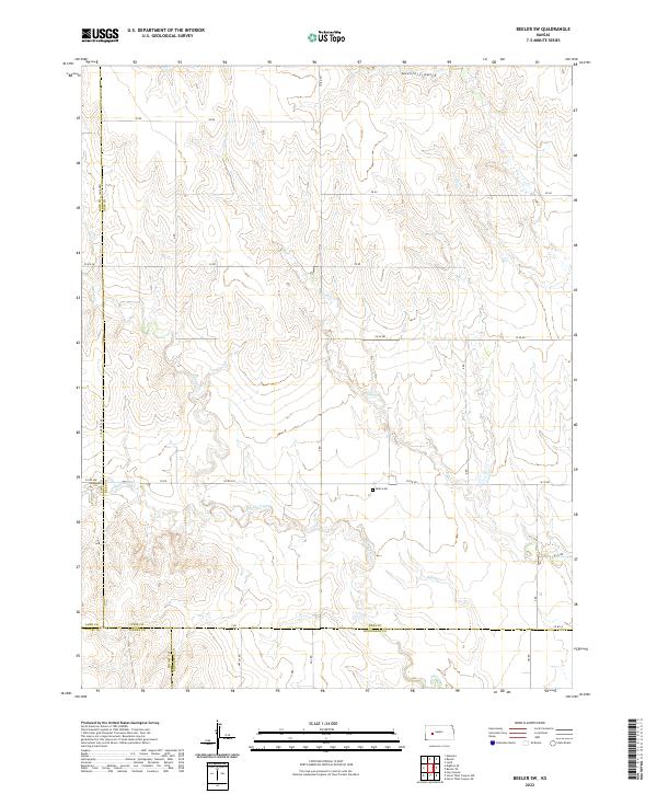
2022 Map of Beeler SW
USGS Topo · Published 2022About this map
Buda Cem sits as a quiet landmark in the southeastern portion of this terrain, marking a point of local heritage where the uplands begin to break toward the drainage of Hackberry Cr. The landscape is defined by a dense network of intermittent watercourses, including Plum Cr and Spring Cr, which have carved intricate patterns into the Kansas prairie. These physical features dictated the placement of the section-line road grid, such as CR 60 and Co RD 523, which navigate the rises and falls of the land. The convergence of multiple county lines, including Lane Co Ness Co and Ness Co Hodgeman Co, underscores the administrative complexity of this rural area, where the boundaries of four different counties meet near the southern edge of the sheet.
Find a feature on this map
30 named features on this map. Tap any name to fly to it.
Don’t see what you’re looking for? This feature index may not catch every label — zoom into the map to look around manually.
Map Details
Editions of this 2022 Beeler SW Map
This is the sole edition of this map. No revisions or reprints were ever made.
Other maps of this area

1955 · Scott City
USGS Topo · 1:250,000

1958 · Scott City
USGS Topo · 1:250,000

1965 · Beeler
USGS Topo · 1:24,000

1966 · Laird
USGS Topo · 1:24,000
1974 · Horse Thief Canyon NE
USGS Topo · 1:24,000
1974 · Beeler SE
USGS Topo · 1:24,000

1974 · Alamota
USGS Topo · 1:24,000

1974 · Hay Canyon
USGS Topo · 1:24,000

1974 · Beeler SW
USGS Topo · 1:24,000

1974 · Dighton SE
USGS Topo · 1:24,000