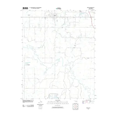
2010 Map of Beggs
USGS Topo · Published 2010About this map
Beggs serves as the central hub for this portion of Okmulgee County, defined by its grid of rural roads and the winding course of the Deep Fork river system. The landscape reflects a well-established rural community where small-scale water management projects, such as the Oknoname 111008 Reservoir, complement natural drainage from Salt Creek and Adams Creek. For genealogists, the map is particularly valuable for its documentation of local burial sites, including the Old Post Oak Cemetery and Stake Cemetery. The distribution of these cemeteries alongside routes like Dentonville Rd and Old Beggs Lake Rd-Hickory suggests the legacy of early land allotments and family settlements. The presence of both the Beggs Dam and New Beggs Lake Dam illustrates the community's evolving reliance on local water reservoirs like Beggs Lake for agricultural or municipal needs.
Find a feature on this map
50 named features on this map. Tap any name to fly to it.
Don’t see what you’re looking for? This feature index may not catch every label — zoom into the map to look around manually.
Map Details
Editions of this 2010 Beggs Map
This is the sole edition of this map. No revisions or reprints were ever made.
Other maps of this area

1896 · Okmulgee
USGS Topo · 1:125,000

1900 · Okmulgee
USGS Topo · 1:125,000

1901 · Nuyaka
USGS Topo · 1:125,000

1914 · Kiefer
USGS Topo · 1:62,500

1916 · Kiefer
USGS Topo · 1:62,500

1946 · Fort Smith
USGS Topo · 1:250,000

1954 · Oklahoma City
USGS Topo · 1:250,000

1957 · Oklahoma City
USGS Topo · 1:250,000

1963 · Oklahoma City
USGS Topo · 1:250,000

1965 · Fort Smith
USGS Topo · 1:250,000