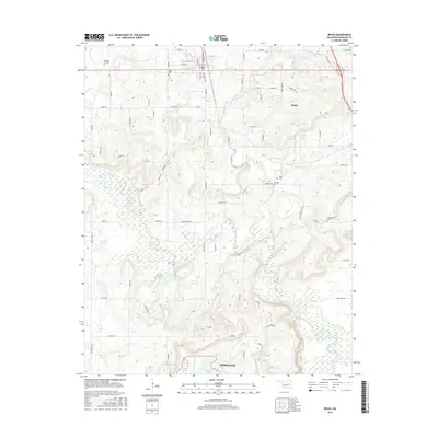
2016 Map of Beggs
USGS Topo · Published 2016About this map
Beggs sits at the northern edge of this Okmulgee County landscape, where the street grid of the town center, including Main St and 9th St, meets the rural countryside. The terrain is defined by the winding course of the Deep Fork river and its many tributaries, such as Negro Cr and Flat Rock Cr. This environment supports numerous small reservoirs and ponds, including New Beggs Lake and the 111008 Reservoir.
Find a feature on this map
68 named features on this map. Tap any name to fly to it.
Don’t see what you’re looking for? This feature index may not catch every label — zoom into the map to look around manually.
Map Details
Editions of this 2016 Beggs Map
This is the sole edition of this map. No revisions or reprints were ever made.
Other maps of this area

1896 · Okmulgee
USGS Topo · 1:125,000

1900 · Okmulgee
USGS Topo · 1:125,000

1901 · Nuyaka
USGS Topo · 1:125,000

1914 · Kiefer
USGS Topo · 1:62,500

1916 · Kiefer
USGS Topo · 1:62,500

1946 · Fort Smith
USGS Topo · 1:250,000

1954 · Oklahoma City
USGS Topo · 1:250,000

1957 · Oklahoma City
USGS Topo · 1:250,000

1963 · Oklahoma City
USGS Topo · 1:250,000

1965 · Fort Smith
USGS Topo · 1:250,000