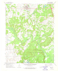
1973 Map of Beggs
USGS Topo · Published 1976About this map
The town of Beggs serves as the primary hub of this Okmulgee County landscape during the early 1970s. The region is defined by a dense network of energy extraction and natural resources, with numerous Oil Wells and a prominent Pipeline cutting across the terrain. Transport is anchored by the St Louis - San Francisco railroad line, which runs through the northern settlements near Adams. To the south, the landscape shifts toward conservation and water management, dominated by the Okmulgee State Game Management Area and the winding course of the Deep Fork. Local history is preserved through scattered burial grounds including Old Post Oak Cem and Stake Cem, while recreation and infrastructure are noted at New Beggs Lake and a Gaging Station on the river. This survey captures a transition point between mid-century industrial oil activity and modern state-managed wilderness conservation.
Find a feature on this map
29 named features on this map. Tap any name to fly to it.
Don’t see what you’re looking for? This feature index may not catch every label — zoom into the map to look around manually.
Map Details
Editions of this 1973 Beggs Map
This is the sole edition of this map. No revisions or reprints were ever made.
Other maps of this area

1896 · Okmulgee
USGS Topo · 1:125,000

1900 · Okmulgee
USGS Topo · 1:125,000

1901 · Nuyaka
USGS Topo · 1:125,000

1914 · Kiefer
USGS Topo · 1:62,500

1916 · Kiefer
USGS Topo · 1:62,500

1946 · Fort Smith
USGS Topo · 1:250,000

1954 · Oklahoma City
USGS Topo · 1:250,000

1957 · Oklahoma City
USGS Topo · 1:250,000

1963 · Oklahoma City
USGS Topo · 1:250,000

1965 · Fort Smith
USGS Topo · 1:250,000