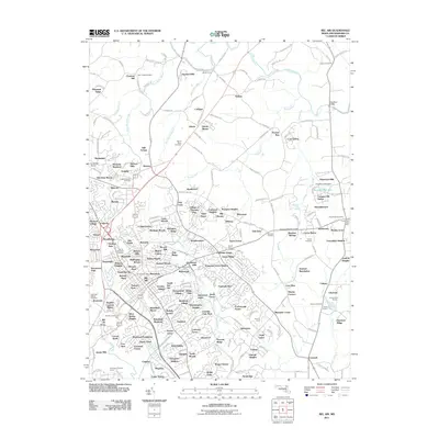
2011 Map of Bel Air
USGS Topo · Published 2011About this map
Deer Creek and its tributaries, including Stout Bottle Branch and Saint Omer Branch, shape the landscape of northern Harford County during this period of suburban expansion. The town of Bel Air serves as a central hub, surrounded by a dense network of residential developments such as Gibson Manor, Village of Thomas Run, and Fairwood Heights. Despite the growth of these neighborhoods, the area maintains ties to its industrial and agricultural past through landmarks like the Michaels Mill Dam on Thomas Run and the Churchville Quarry near James Run.
Find a feature on this map
238 named features on this map. Tap any name to fly to it.
Don’t see what you’re looking for? This feature index may not catch every label — zoom into the map to look around manually.
Map Details
Editions of this 2011 Bel Air Map
This is the sole edition of this map. No revisions or reprints were ever made.
Other maps of this area

1893 · Gunpowder
USGS Topo · 1:62,500

1898 · Tolchester
USGS Topo · 1:125,000

1900 · Havre De Grace
USGS Topo · 1:62,500

1900 · Betterton
USGS Topo · 1:62,500

1901 · Belair
USGS Topo · 1:62,500

1901 · Gunpowder
USGS Topo · 1:62,500

1903 · Tolchester
USGS Topo · 1:125,000

1908 · Tolchester
USGS Topo · 1:125,000

1941 · Gunpowder
USGS Topo · 1:62,500

1942 · Havre De Grace
USGS Topo · 1:62,500