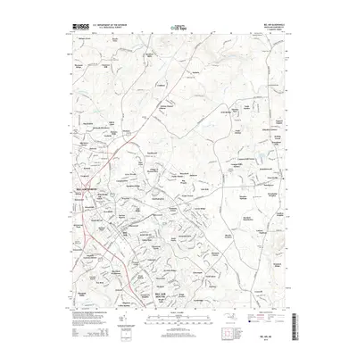
2014 Map of Bel Air
USGS Topo · Published 2014About this map
Deer Creek and its many tributaries, including Saint Omer Br and Stout-Bottle Br, define the landscape of northern Harford County. This 2014 survey documents a region where established agricultural heritage meets modern suburban expansion, centered around Hickory and the northern reaches of Bel Air. The map is a valuable resource for genealogists, marking numerous burial grounds such as Trappe Cem, Mt Zion Cem, and the Saint Ignatius Cem near Hickory Hills. Transportation and local infrastructure are prominently featured, from the Priestford Bridge crossing to the presence of local aviation sites like Moxley's Airport and Forest Hill Airport. The transition from rural creek valleys to educational hubs like Harford Community Coll reflects the area's ongoing development in the 21st century.
Find a feature on this map
323 named features on this map. Tap any name to fly to it.
Don’t see what you’re looking for? This feature index may not catch every label — zoom into the map to look around manually.
Map Details
Editions of this 2014 Bel Air Map
This is the sole edition of this map. No revisions or reprints were ever made.
Other maps of this area

1893 · Gunpowder
USGS Topo · 1:62,500

1898 · Tolchester
USGS Topo · 1:125,000

1900 · Havre De Grace
USGS Topo · 1:62,500

1900 · Betterton
USGS Topo · 1:62,500

1901 · Belair
USGS Topo · 1:62,500

1901 · Gunpowder
USGS Topo · 1:62,500

1903 · Tolchester
USGS Topo · 1:125,000

1908 · Tolchester
USGS Topo · 1:125,000

1941 · Gunpowder
USGS Topo · 1:62,500

1942 · Havre De Grace
USGS Topo · 1:62,500