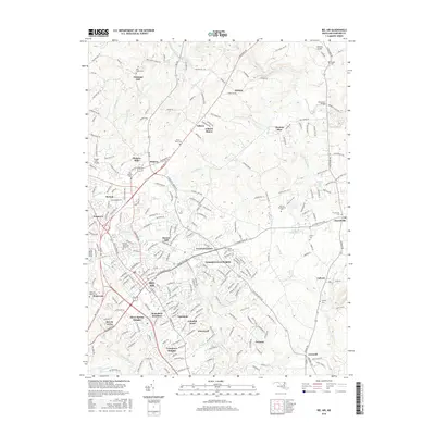
2016 Map of Bel Air
USGS Topo · Published 2016About this map
Bel Air serves as the focal point of this Harford County landscape, showing the dense residential expansion into neighborhoods like Wakefield Meadows and Fountain Green Heights. The map documents a blend of established town centers and outlying rural hamlets such as Chestnut Hill, Kalmia, and Gibson. To the northeast, the terrain is defined by the winding course of Deer Creek, crossed by the Priestford Bridge. Educational and commemorative sites are prominent, from the sprawling campus of Harford Community College to numerous historic burial grounds including Asbury Cemetery and Saint Ignatius Cemetery. The presence of Michaels Mill Dam on Deer Creek and the settlement at Moores Mill point to the area's legacy of water-powered industry along the regional runs and branches.
Find a feature on this map
264 named features on this map. Tap any name to fly to it.
Don’t see what you’re looking for? This feature index may not catch every label — zoom into the map to look around manually.
Map Details
Editions of this 2016 Bel Air Map
This is the sole edition of this map. No revisions or reprints were ever made.
Other maps of this area

1893 · Gunpowder
USGS Topo · 1:62,500

1898 · Tolchester
USGS Topo · 1:125,000

1900 · Havre De Grace
USGS Topo · 1:62,500

1900 · Betterton
USGS Topo · 1:62,500

1901 · Belair
USGS Topo · 1:62,500

1901 · Gunpowder
USGS Topo · 1:62,500

1903 · Tolchester
USGS Topo · 1:125,000

1908 · Tolchester
USGS Topo · 1:125,000

1941 · Gunpowder
USGS Topo · 1:62,500

1942 · Havre De Grace
USGS Topo · 1:62,500