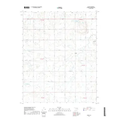
2018 Map of Beland
USGS Topo · Published 2018About this map
Taft and the smaller community of Beland serve as the primary focal points in this section of Muskogee County. The landscape is defined by a network of drainage systems and artificial water bodies, most notably the twin reservoirs of Taft Lake Number 3 and Taft Lake Number 2 situated north of the Beland settlement. The terrain transitions from the lowlands of Pecan Cr and Cloud Creek toward the elevation of Baucum Hill in the northeast. Genealogists will find the locations of Doyle Cem and Brown Cem valuable for tracing local family histories. The area's infrastructure is characterized by a strict grid of section roads, including Chimney Mountain Rd, which provide access to the rural homesteads and agricultural tracts located between several watershed projects like the Cane Cr Reservoir.
Find a feature on this map
65 named features on this map. Tap any name to fly to it.
Don’t see what you’re looking for? This feature index may not catch every label — zoom into the map to look around manually.
Map Details
Editions of this 2018 Beland Map
This is the sole edition of this map. No revisions or reprints were ever made.
Other maps of this area

1896 · Okmulgee
USGS Topo · 1:125,000

1900 · Okmulgee
USGS Topo · 1:125,000

1901 · Muscogee
USGS Topo · 1:125,000

1905 · Muscogee
USGS Topo · 1:125,000

1946 · Fort Smith
USGS Topo · 1:250,000

1948 · Keefeton
USGS Topo · 1:62,500

1948 · Wagoner
USGS Topo · 1:62,500

1950 · Keefeton
USGS Topo · 1:62,500

1950 · Wagoner
USGS Topo · 1:62,500

1965 · Fort Smith
USGS Topo · 1:250,000