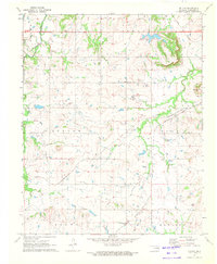
1971 Map of Beland
USGS Topo · Published 1972About this map
Beland sits at the crossing of the St Louis San Francisco and Texas and Pacific railroads, serving as a focal point in a landscape defined by small rural congregations and the legacy of early Oklahoma oil development. This 1971 survey captures an active Oil Field and the pipelines that supported the regional energy economy during the late 20th century. For those researching local families, the map provides precise locations for the Doyle Cem and Brown Cem, as well as several country churches including Wilson Chapel, Mt Pleasant Ch, and Cloud Creek Ch. The presence of the Taft Institution Lake in the northeast corner and the land divisions of Sutton and Agency reflect the institutional and administrative history of Muskogee County. Drainage follows the winding paths of Cloud Creek and Pecan Creek, which cut through the undulating terrain near Baucum Hill.
Find a feature on this map
18 named features on this map. Tap any name to fly to it.
Don’t see what you’re looking for? This feature index may not catch every label — zoom into the map to look around manually.
Map Details
Editions of this 1971 Beland Map
This is the sole edition of this map. No revisions or reprints were ever made.
Other maps of this area

1896 · Okmulgee
USGS Topo · 1:125,000

1900 · Okmulgee
USGS Topo · 1:125,000

1901 · Muscogee
USGS Topo · 1:125,000

1905 · Muscogee
USGS Topo · 1:125,000

1946 · Fort Smith
USGS Topo · 1:250,000

1948 · Keefeton
USGS Topo · 1:62,500

1948 · Wagoner
USGS Topo · 1:62,500

1950 · Keefeton
USGS Topo · 1:62,500

1950 · Wagoner
USGS Topo · 1:62,500

1965 · Fort Smith
USGS Topo · 1:250,000