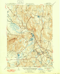
1943 Map of Belchertown
USGS Topo · Published 1950About this map
The town of Belchertown and its surrounding Hampshire County uplands are documented here just after World War II, revealing a landscape defined by glacial lakes and a transition from agricultural roots to institutional growth. The Central Vermont and Boston and Maine railroads intersect this terrain, serving established settlements like Dwight and Cooks Corner. Significant local landmarks include the State School and St Hyacinths Seminary, reflecting the large-scale social and religious infrastructure of mid-century Massachusetts.
Find a feature on this map
59 named features on this map. Tap any name to fly to it.
Don’t see what you’re looking for? This feature index may not catch every label — zoom into the map to look around manually.
Map Details
Editions of this 1943 Belchertown Map
4 editions found
Other maps of this area

1885 · Northampton
USGS Topo · 1:62,500

1886 · Springfield
USGS Topo · 1:62,500

1886 · Northampton
USGS Topo · 1:62,500

1887 · Palmer
USGS Topo · 1:62,500

1887 · Belchertown
USGS Topo · 1:62,500

1889 · Springfield
USGS Topo · 1:62,500

1889 · Palmer
USGS Topo · 1:62,500

1890 · Belchertown
USGS Topo · 1:62,500

1891 · Northampton
USGS Topo · 1:62,500

1893 · Northampton
USGS Topo · 1:62,500