
1968 Map of Belcourt
USGS Topo · Published 1973About this map
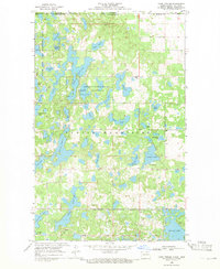
The Turtle Mountain Indian Reservation Boundary defines the northern landscape of this survey, where the Turtle Mountains rise above the surrounding prairie. This area, documented in the late 1960s, is dotted with numerous water bodies including Belcourt Lake, Syrian Lake, and Martin Lake. Cultural significance is noted by the An-qui-ni-gay Indian Burial Ground and St Paul Cem near the primary settlement of Belcourt. To the east, the Burlington Northern railroad corridor serves the community of Rolla, reflecting the transport patterns essential to this region of Rolette County. The southern portion of the map is dominated by the rural township of Maryville, marked by scattered farms and the Maryville Cem, illustrating the transition from the wooded hills to the open plains where features like Townhall and various Gravel Pit locations appear.
Find a feature on this map
20 named features on this map. Tap any name to fly to it.
Don’t see what you’re looking for? This feature index may not catch every label — zoom into the map to look around manually.
Map Details
Editions of this 1968 Belcourt Map
This is the sole edition of this map. No revisions or reprints were ever made.
Other maps of this area

1936 · Lake Upsilon
USGS Topo · 1:48,000

1942 · Lake Upsilon
USGS Topo · 1:62,500

1953 · Devils Lake
USGS Topo · 1:250,000

1956 · Devils Lake
USGS Topo · 1:250,000

1968 · Lake Upsilon SE
USGS Topo · 1:24,000
1968 · Lake Upsilon
USGS Topo · 1:24,000

1969 · Saint John
USGS Topo · 1:24,000

1969 · Rolla NE
USGS Topo · 1:24,000

1970 · Rolla
USGS Topo · 1:24,000

1971 · Mylo
USGS Topo · 1:24,000