
1969 Map of Saint John
USGS Topo · Published 1972About this map
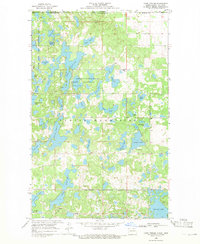
The town of Saint John sits just south of the international border in Rolette County, serving as a gateway between North Dakota and Manitoba. This 1969 field-checked survey reveals the complex geography of the Turtle Mountain Indian Reservation, where the landscape is defined by a dense network of small glacial lakes and wetlands, including Byrnes Lake and Syrian Lake. The infrastructure of the era is anchored by the Burlington Northern railroad line cutting through the prairie toward the border, where the Port of Entry US Customs marks the transit point into Canada.
Find a feature on this map
19 named features on this map. Tap any name to fly to it.
Don’t see what you’re looking for? This feature index may not catch every label — zoom into the map to look around manually.
Map Details
Editions of this 1969 Saint John Map
This is the sole edition of this map. No revisions or reprints were ever made.
Other maps of this area

1936 · Lake Upsilon
USGS Topo · 1:48,000

1942 · Lake Upsilon
USGS Topo · 1:62,500

1953 · Devils Lake
USGS Topo · 1:250,000

1956 · Devils Lake
USGS Topo · 1:250,000

1968 · Lake Upsilon SE
USGS Topo · 1:24,000
1968 · Lake Upsilon
USGS Topo · 1:24,000

1968 · Belcourt
USGS Topo · 1:24,000

1969 · Rolla NE
USGS Topo · 1:24,000

1970 · Rolla
USGS Topo · 1:24,000

1985 · Rock Lake
USGS Topo · 1:100,000