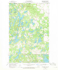
1968 Map of Lake Upsilon
USGS Topo · Published 1971About this map
Turtle Mountains terrain dominates this 1968 landscape, characterized by a dense concentration of glacial lakes along the international border between North Dakota and Manitoba. The area serves as a significant conservation and recreation hub, highlighted by the Wakopa State Game Management Area and the St John Game Farm. Central to the geography is Lake Upsilon, surrounded by numerous smaller water bodies such as Walker Lake, Gordon Lake, and Belcourt Lake.
Find a feature on this map
42 named features on this map. Tap any name to fly to it.
Don’t see what you’re looking for? This feature index may not catch every label — zoom into the map to look around manually.
Map Details
Editions of this 1968 Lake Upsilon Map
This is the sole edition of this map. No revisions or reprints were ever made.
Other maps of this area

1936 · Lake Upsilon
USGS Topo · 1:48,000

1942 · Lake Upsilon
USGS Topo · 1:62,500

1953 · Devils Lake
USGS Topo · 1:250,000

1955 · Lake Upsilon SW
USGS Topo · 1:24,000

1956 · Devils Lake
USGS Topo · 1:250,000

1968 · Lake Upsilon SE
USGS Topo · 1:24,000
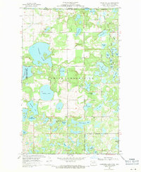
1968 · Carpenter Lake
USGS Topo · 1:24,000

1968 · Belcourt
USGS Topo · 1:24,000

1969 · Saint John
USGS Topo · 1:24,000

1985 · Rock Lake
USGS Topo · 1:100,000