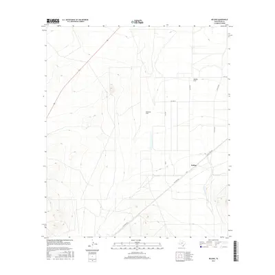
2016 Map of Belding
USGS Topo · Published 2016About this map
Belding is situated in the high desert of Pecos County, where the landscape is defined by its drainage patterns and a utilitarian grid of ranch roads. The topography is marked by significant features like Acebuche Draw and Belding Draw, which cut through the terrain and suggest the historical movement of water across this semi-arid region. Transportation routes converge near the settlement, including the Old Alpine Hwy and Ranch Rd 2037, reflecting a local economy tied to livestock and transit. Unlike many mountainous regions, this area exhibits a fascinating mix of wide, flat basins and rising elevations to the west. Local thoroughfares such as Williams Rd, Pecan Rd, and Srangus Rd provide a clear view of how rural property was partitioned and accessed in the early 21st century.
Find a feature on this map
11 named features on this map. Tap any name to fly to it.
Don’t see what you’re looking for? This feature index may not catch every label — zoom into the map to look around manually.
Map Details
Editions of this 2016 Belding Map
This is the sole edition of this map. No revisions or reprints were ever made.
Other maps of this area

1921 · Fort Stockton
USGS Topo · 1:62,500

1923 · Fort Stockton
USGS Topo · 1:62,500

1923 · Sierra Madera
USGS Topo · 1:62,500

1928 · Comanche Spring
USGS Topo · 1:125,000

1929 · Hovey
USGS Topo · 1:125,000

1954 · Fort Stockton
USGS Topo · 1:250,000

1958 · Fort Stockton
USGS Topo · 1:250,000

1970 · Belding SW
USGS Topo · 1:24,000

1970 · Fort Stockton West
USGS Topo · 1:24,000

1970 · Twelvemile Mesa
USGS Topo · 1:24,000