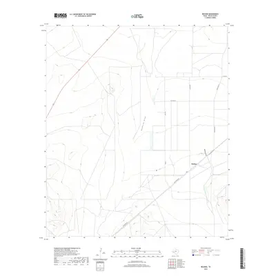
2019 Map of Belding
USGS Topo · Published 2019About this map
Belding sits at a geographic crossroads in Pecos County, where the desert floor meets the rising elevations of the southwest. The landscape is defined by the ephemeral drainage of Acebuche Draw and Belding Draw, which cut through the terrain toward the lower basins. This 2019 survey documents the modern infrastructure of the region, showing the transition from regional routes like Old Alpine Hwy and Ranch Rd 2037 to local access roads such as Williams Rd and Skangus Rd. The map illustrates a structured agricultural or ranching grid, particularly evident along Pecan Rd, set against the open West Texas range. It captures the spatial relationship between these transport corridors and the natural topography of the Trans-Pecos, providing a clear view of how water and travel have shaped the local settlement patterns.
Find a feature on this map
12 named features on this map. Tap any name to fly to it.
Don’t see what you’re looking for? This feature index may not catch every label — zoom into the map to look around manually.
Map Details
Editions of this 2019 Belding Map
This is the sole edition of this map. No revisions or reprints were ever made.
Other maps of this area

1921 · Fort Stockton
USGS Topo · 1:62,500

1923 · Fort Stockton
USGS Topo · 1:62,500

1923 · Sierra Madera
USGS Topo · 1:62,500

1928 · Comanche Spring
USGS Topo · 1:125,000

1929 · Hovey
USGS Topo · 1:125,000

1954 · Fort Stockton
USGS Topo · 1:250,000

1958 · Fort Stockton
USGS Topo · 1:250,000

1970 · Belding SW
USGS Topo · 1:24,000

1970 · Fort Stockton West
USGS Topo · 1:24,000

1970 · Twelvemile Mesa
USGS Topo · 1:24,000