
1969 Map of Belews Creek
USGS Topo · Published 1972About this map
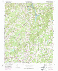
Belews Lake dominates the upper reaches of this landscape on the border of Forsyth and Guilford Counties. As surveyed in the late 1960s, the terrain shows a transition from the developing town of Kernersville in the south toward the rural crossroads and church-centered communities of the north. The Southern railroad line cuts across the topography, connecting Talleys Crossing and the local Quarry to larger markets, while water resources are managed through the Filtration Plant and Kernersville Lake. Local genealogy and community history are anchored by numerous country churches, including Pine Ridge Ch, Antioch Ch, and White Oak Grove Ch. Long-established transit routes like Old Flatrock Road and Stafford Mill Road provide a look at the historic road network that preceded modern highway expansion in this part of the North Carolina Piedmont.
Find a feature on this map
32 named features on this map. Tap any name to fly to it.
Don’t see what you’re looking for? This feature index may not catch every label — zoom into the map to look around manually.
Map Details
Editions of this 1969 Belews Creek Map
Other maps of this area

1950 · Winston-Salem East
USGS Topo · 1:24,000

1951 · Winston-Salem East
USGS Topo · 1:24,000

1951 · Guilford
USGS Topo · 1:24,000

1951 · Walkertown
USGS Topo · 1:24,000

1953 · Winston-Salem
USGS Topo · 1:250,000

1953 · Greensboro
USGS Topo · 1:250,000

1954 · Greensboro
USGS Topo · 1:250,000

1955 · Winston-Salem
USGS Topo · 1:250,000

1962 · Winston-Salem
USGS Topo · 1:250,000

1962 · Greensboro
USGS Topo · 1:250,000