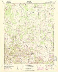
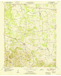
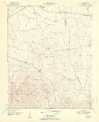
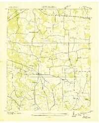
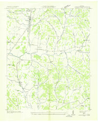
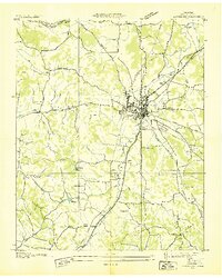
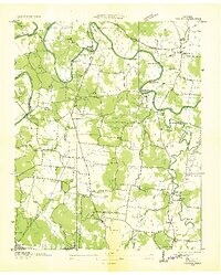
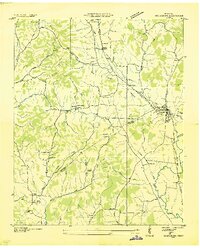
1951 Map of Belfast
USGS Topo · Published 1967About this map
Belfast sits at the heart of this Tennessee landscape, where the Nashville Chattanooga and St Louis Railway cuts through the lowlands of Belfast Creek. The map documents a rural society built around local institutions, including Cedar Grove School, Union Sch, and numerous hilltop houses of worship like Rocky Point Church and Beech Hill Church. To the north, the historic Confederate Memorial Park marks the edge of Farmington, while family history is etched across the map in sites like Bills Cem, O'Neal Cem, and Erwin Cem.
Find a feature on this map
64 named features on this map. Tap any name to fly to it.
Don’t see what you’re looking for? This feature index may not catch every label — zoom into the map to look around manually.
Map Details
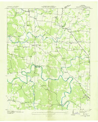
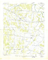
Editions of this 1951 Belfast Map
3 editions found
Other maps of this area
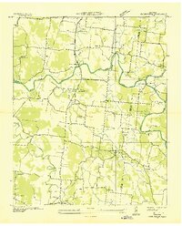
1936 · Farmington
USGS Topo · 1:24,000
1936 · Belfast
USGS Topo · 1:24,000
1936 · Cornersville
USGS Topo · 1:24,000
1936 · Lewisburg
USGS Topo · 1:24,000

1936 · Belleville
USGS Topo · 1:24,000
1936 · Verona
USGS Topo · 1:24,000
1936 · Petersburg
USGS Topo · 1:24,000
1936 · Unionville
USGS Topo · 1:24,000
1936 · Bedford
USGS Topo · 1:24,000

1944 · Shelbyville
USGS Topo · 1:100,000