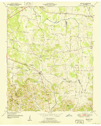
1951 Map of Belfast
USGS Topo · Published 1951About this map
The Belfast community and the surrounding rural landscapes of Marshall County are captured here just after the mid-century. This region is defined by the prominent Elk Ridge and the Nashville Chattanooga and St Louis Railroad, which cuts through the terrain near Blackwell Crossing. The map reveals a high density of small-scale social infrastructure, including Cedar Grove School and Union Sch, alongside numerous country churches like Head Springs Church and Rocky Point Church.
Find a feature on this map
63 named features on this map. Tap any name to fly to it.
Don’t see what you’re looking for? This feature index may not catch every label — zoom into the map to look around manually.
Map Details
Editions of this 1951 Belfast Map
3 editions found
Other maps of this area

1936 · Farmington
USGS Topo · 1:24,000

1936 · Belfast
USGS Topo · 1:24,000

1936 · Cornersville
USGS Topo · 1:24,000

1936 · Lewisburg
USGS Topo · 1:24,000

1936 · Belleville
USGS Topo · 1:24,000

1936 · Verona
USGS Topo · 1:24,000

1936 · Petersburg
USGS Topo · 1:24,000

1936 · Unionville
USGS Topo · 1:24,000

1936 · Bedford
USGS Topo · 1:24,000

1944 · Shelbyville
USGS Topo · 1:100,000