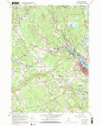
1960 Map of Belfast
USGS Topo · Published 1984About this map
The coastal city of Belfast serves as the focal point for this mid-century survey, situated where the Passagassawakeag River meets the Belfast Bay. The urban center is characterized by a dense grid of streets such as High Street and Congress St, supporting civic infrastructure like the Armory and several local schools, including the Anderson Sch and Robertson Sch. Beyond the city limits, the landscape transitions into a network of small crossroads settlements and family-named corners, such as Kendalls Corner and Neals Corner, which define the rural character of Waldo and Swanville.
Find a feature on this map
102 named features on this map. Tap any name to fly to it.
Don’t see what you’re looking for? This feature index may not catch every label — zoom into the map to look around manually.
Map Details
Editions of this 1960 Belfast Map
4 editions found
Other maps of this area

1900 · Bucksport
USGS Topo · 1:62,500

1902 · Bucksport
USGS Topo · 1:62,500

1902 · Castine
USGS Topo · 1:62,500

1904 · Castine
USGS Topo · 1:62,500

1905 · Penobscot Bay
USGS Topo · 1:125,000

1915 · Belfast
USGS Topo · 1:62,500

1917 · Belfast
USGS Topo · 1:62,500

1932 · Brooks
USGS Topo · 1:62,500

1941 · Belfast
USGS Topo · 1:62,500

1941 · Castine
USGS Topo · 1:62,500