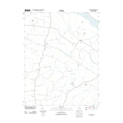
2012 Map of Belgique
USGS Topo · Published 2012About this map
Belgique and McBride sit on the fertile plains of the Mississippi River bottomlands, a landscape defined by the shifting course of the great river and its various side channels like Missouri Chute. This 2012 survey illustrates a region where agriculture and aviation meet, evidenced by the Perryville Municipal Airport and the network of farm-to-market roads such as Co Hwy 236. Further inland, the terrain transitions into a more dissected topography drained by Bois Brule Creek and Cinque Hommes Creek, where smaller communities like Sereno are established. Local history is anchored by the Nativity Cemetery and Preston Cemetery, while industrial remnants like McClannahan Mill suggest the area's long-standing reliance on its water resources. The presence of Crains Island and Puckett Island highlights the dynamic nature of the river border between Missouri and Illinois.
Find a feature on this map
64 named features on this map. Tap any name to fly to it.
Don’t see what you’re looking for? This feature index may not catch every label — zoom into the map to look around manually.
Map Details
Editions of this 2012 Belgique Map
This is the sole edition of this map. No revisions or reprints were ever made.
Other maps of this area

1915 · Chester
USGS Topo · 1:62,500

1916 · Campbell Hill
USGS Topo · 1:62,500

1918 · Altenburg
USGS Topo · 1:62,500

1918 · Campbell Hill
USGS Topo · 1:62,500

1923 · Perryville
USGS Topo · 1:62,500

1924 · Perryville
USGS Topo · 1:62,500

1925 · Altenburg
USGS Topo · 1:62,500

1947 · Chester
USGS Topo · 1:62,500

1947 · Crosstown
USGS Topo · 1:24,000

1947 · Altenburg
USGS Topo · 1:62,500