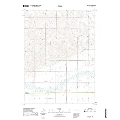
2017 Map of Belgrade SW
USGS Topo · Published 2017About this map
Loup River dominates the southern landscape of this Nebraska survey, cutting through the boundary where Nance Co meets Merrick Co. The terrain is defined by a dense network of sectional roads and the intricate drainage of Cottonwood Cr and Horse Cr as they move toward the river valley. Near the northern edge, the small community of North Star sits at the intersection of N Pawnee Rd and N Star Rd, serving as a local anchor in this agricultural region. The inclusion of the Davis Brothers Reservoir highlights local water management practices essential for the area's farming economy. Researchers can trace the precise cadastral lines of T15N and T16N, seeing how the grid of local avenues like N 140th Ave and N 170th Ave organizes the rural homesteads and fields between the river and the northern uplands.
Find a feature on this map
40 named features on this map. Tap any name to fly to it.
Don’t see what you’re looking for? This feature index may not catch every label — zoom into the map to look around manually.
Map Details
Editions of this 2017 Belgrade SW Map
This is the sole edition of this map. No revisions or reprints were ever made.
Other maps of this area

1899 · St. Paul
USGS Topo · 1:125,000

1954 · Wolbach NE
USGS Topo · 1:24,000

1954 · Belgrade
USGS Topo · 1:24,000

1954 · Belgrade NW
USGS Topo · 1:24,000

1955 · Belgrade SW
USGS Topo · 1:24,000

1955 · Broken Bow
USGS Topo · 1:250,000

1955 · Belgrade SE
USGS Topo · 1:24,000

1955 · Cushing
USGS Topo · 1:24,000

1956 · Broken Bow
USGS Topo · 1:250,000
1961 · Palmer
USGS Topo · 1:24,000