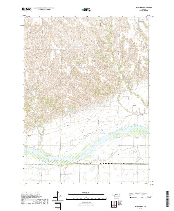
2021 Map of Belgrade SW
USGS Topo · Published 2021About this map
The Loup River dominates the southern landscape of this Nebraska quadrangle, its braided channels and sandbars crossing the border between Nance Co and Merrick Co. North of the river, the terrain rises into the rolling uplands of the Loess Hills, where a geometric grid of rural section roads like N 140th Ave and Valley Rd connects isolated farmsteads and agricultural operations. The small settlement of North Star sits at the northern edge of the survey, serving as a primary local landmark for the surrounding ranching and farming community.
Find a feature on this map
39 named features on this map. Tap any name to fly to it.
Don’t see what you’re looking for? This feature index may not catch every label — zoom into the map to look around manually.
Map Details
Editions of this 2021 Belgrade SW Map
This is the sole edition of this map. No revisions or reprints were ever made.
Other maps of this area

1899 · St. Paul
USGS Topo · 1:125,000

1954 · Wolbach NE
USGS Topo · 1:24,000

1954 · Belgrade
USGS Topo · 1:24,000

1954 · Belgrade NW
USGS Topo · 1:24,000

1955 · Belgrade SW
USGS Topo · 1:24,000

1955 · Broken Bow
USGS Topo · 1:250,000

1955 · Belgrade SE
USGS Topo · 1:24,000

1955 · Cushing
USGS Topo · 1:24,000

1956 · Broken Bow
USGS Topo · 1:250,000
1961 · Palmer
USGS Topo · 1:24,000