
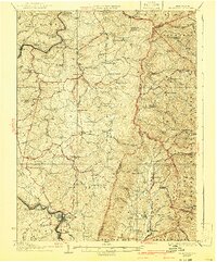
1927 Map of Belington
USGS Topo · Published 1927About this map
The Tygart River winds through this 1920s Appalachian landscape, a region defined by scattered mountain communities and a maturing rail infrastructure. The southern hub of Belington serves as a primary junction where the Baltimore and Ohio RR and Western Maryland RR converge. This period shows a high density of rural institutions, with local schools like St Joseph School and Cave Hill School serving isolated hollows and ridges. The presence of Vannoy's Mill and the community at Valley Furnace point to the area's transition from early industrial roots to a more established network of small villages.
Find a feature on this map
110 named features on this map. Tap any name to fly to it.
Don’t see what you’re looking for? This feature index may not catch every label — zoom into the map to look around manually.
Map Details
Editions of this 1927 Belington Map
2 editions found
Other maps of this area

1886 · St. George
USGS Topo · 1:125,000

1889 · Beverly
USGS Topo · 1:125,000

1891 · St. George
USGS Topo · 1:125,000

1892 · Beverly
USGS Topo · 1:125,000

1893 · Buckhannon
USGS Topo · 1:125,000

1896 · Buckhannon
USGS Topo · 1:125,000

1897 · Buckhannon
USGS Topo · 1:125,000

1902 · Fairmont
USGS Topo · 1:62,500

1904 · Philippi
USGS Topo · 1:62,500

1907 · Thornton
USGS Topo · 1:62,500