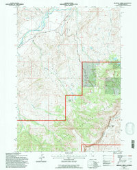
1991 Map of Belknap Creek
USGS Topo · Published 1997About this map
The South Fork Shoshone River flows through the northern reaches of this Wyoming landscape, defining a valley carved by glacial and fluvial action. This 1991 revision, based on earlier aerial photography, highlights a sophisticated network of irrigation infrastructure including the Neff Ditch, Rock Ditch, and Lakeview Ditch. These diversions signify the historical efforts to manage water in the arid high-elevation environment of Park County.
Find a feature on this map
37 named features on this map. Tap any name to fly to it.
Don’t see what you’re looking for? This feature index may not catch every label — zoom into the map to look around manually.
Map Details
Editions of this 1991 Belknap Creek Map
This is the sole edition of this map. No revisions or reprints were ever made.
Other maps of this area

1955 · Cody
USGS Topo · 1:250,000

1957 · Wapiti
USGS Topo · 1:62,500

1957 · Devils Tooth
USGS Topo · 1:62,500

1957 · Irish Rock
USGS Topo · 1:62,500

1957 · Sunshine Reservoir
USGS Topo · 1:62,500

1958 · Cody
USGS Topo · 1:250,000

1962 · Cody
USGS Topo · 1:250,000

1980 · Carter Mountain
USGS Topo · 1:100,000
1987 · Devils Tooth
USGS Topo · 1:24,000
1987 · Irma Flats
USGS Topo · 1:24,000