
1980 Map of Carter Mountain
USGS Topo · Published 1982About this map
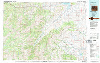
Carter Mountain and the high ridges of the Shoshone National Forest dominate this 1980 survey, which details the complex hydrological and industrial landscape of Park County. The map tracks the convergence of the North Fork Shoshone River and South Fork Shoshone River into the Buffalo Bill Reservoir, alongside the extensive drainage systems of Ishawooa Creek and Thorofare Creek.
Find a feature on this map
59 named features on this map. Tap any name to fly to it.
Don’t see what you’re looking for? This feature index may not catch every label — zoom into the map to look around manually.
Map Details
Editions of this 1980 Carter Mountain Map
3 editions found
Other maps of this area

1885 · Lake
USGS Topo · 1:125,000

1886 · Canyon
USGS Topo · 1:125,000

1893 · Ishawooa
USGS Topo · 1:125,000

1895 · Ishawooa
USGS Topo · 1:125,000

1895 · Canyon
USGS Topo · 1:125,000

1895 · Lake
USGS Topo · 1:125,000

1896 · Lake
USGS Topo · 1:125,000

1896 · Canyon
USGS Topo · 1:125,000

1896 · Crandall Creek
USGS Topo · 1:125,000

1899 · Crandall
USGS Topo · 1:125,000