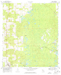
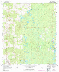
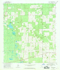
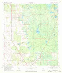
1968 Map of Bell
USGS Topo · Published 1977About this map
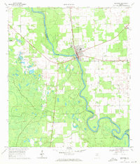
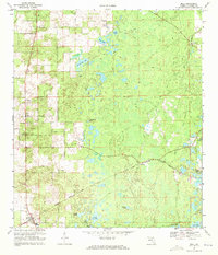
Bell serves as the primary hub for this portion of Gilchrist County, situated along the Seaboard Coast Line railroad. The landscape is defined by its karst topography, dotted with numerous water bodies such as Sevenmile Lake, Half Moon Pond, and Bone Pond. A network of unpaved paths and Jeep Trails crisscrosses the terrain, connecting isolated locations like Williford to the larger settlements.
Find a feature on this map
29 named features on this map. Tap any name to fly to it.
Don’t see what you’re looking for? This feature index may not catch every label — zoom into the map to look around manually.
Map Details
Editions of this 1968 Bell Map
3 editions found
Other maps of this area

1954 · Gainesville
USGS Topo · 1:250,000

1958 · Gainesville
USGS Topo · 1:250,000

1959 · Gainesville
USGS Topo · 1:250,000
1968 · Waters Lake
USGS Topo · 1:24,000
1968 · Fourmile Lake
USGS Topo · 1:24,000
1968 · Branford
USGS Topo · 1:24,000
1968 · Hatchbend
USGS Topo · 1:24,000
1968 · Hildreth
USGS Topo · 1:24,000
1968 · Wannee
USGS Topo · 1:24,000
1968 · Bell
USGS Topo · 1:24,000