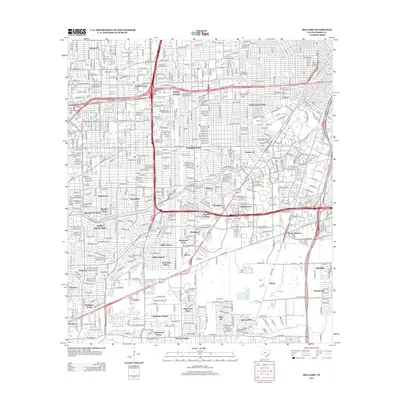
2013 Map of Bellaire
USGS Topo · Published 2013About this map
Bellaire Junction sits at the heart of this highly developed urban landscape, where complex freeway interchanges like the SW FWY and W Loop S slice through established residential neighborhoods. This area of Southwest Houston is defined by its organized subdivision patterns, ranging from the older footprints of Lamar Terrace and Southside Place to mid-century developments such as Meyerland and Westbury South.
Find a feature on this map
53 named features on this map. Tap any name to fly to it.
Don’t see what you’re looking for? This feature index may not catch every label — zoom into the map to look around manually.
Map Details
Editions of this 2013 Bellaire Map
This is the sole edition of this map. No revisions or reprints were ever made.
Other maps of this area

1915 · Bellaire
USGS Topo · 1:24,000

1915 · Park Place
USGS Topo · 1:24,000

1915 · Houston Heights
USGS Topo · 1:24,000

1915 · Alief
USGS Topo · 1:24,000

1915 · Hillendahl
USGS Topo · 1:24,000

1916 · Settegast
USGS Topo · 1:24,000

1918 · Hillendahl
USGS Topo · 1:31,680

1920 · Mykawa
USGS Topo · 1:31,680

1920 · Almeda
USGS Topo · 1:31,680

1921 · Bellaire
USGS Topo · 1:31,680