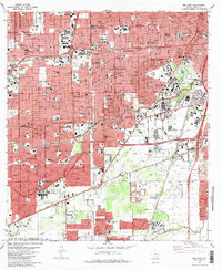
2022 Map of Bellaire
USGS Topo · Published 2022About this map
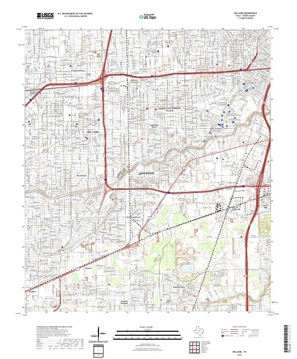
Houston and its southwestern enclaves are shown in extensive detail, documenting the modern urban landscape of Harris County. The independent municipality of Bellaire is surrounded by the city's continuous growth, while West University Place maintains its distinct residential character. The area is a significant educational corridor, anchoring institutions such as Rice University, the Baylor College of Medicine, and the University of Saint Thomas Houston. The hydrological network, including Brays Bayou and Sims Bayou, intersects the grid of major thoroughfares like the S Loop Fwy and Bellaire Blvd. Smaller neighborhoods like Lamar Terrace, Meyerland, and Westwood Park reflect decades of post-war residential development. Local history and genealogy are preserved at sites like the Saint John The Divine Episcopal Church Cem and the Saint Luke's United Methodist Memorial Garden, providing focal points for local researchers.
Find a feature on this map
49 named features on this map. Tap any name to fly to it.
Don’t see what you’re looking for? This feature index may not catch every label — zoom into the map to look around manually.
Map Details
Editions of this 2022 Bellaire Map
This is the sole edition of this map. No revisions or reprints were ever made.
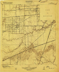
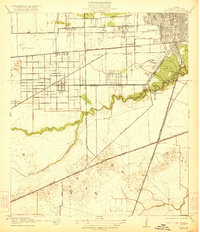
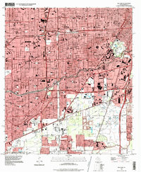
Historical Maps of Almeda Plaza Through Time
5 maps found