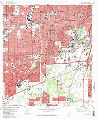
1982 Map of Bellaire
USGS Topo · Published 1983About this map
The growing metropolitan footprint of southwest Houston and the independent enclave of Bellaire are captured here in the early 1980s. This survey highlights a period of intense institutional and commercial development, anchored by the massive Texas Medical Center and the academic grounds of Rice University. The landscape is defined by the convergence of the Southwest Freeway, the West Loop, and the South Loop, which together facilitated the suburban expansion into areas like West University Place.
Find a feature on this map
71 named features on this map. Tap any name to fly to it.
Don’t see what you’re looking for? This feature index may not catch every label — zoom into the map to look around manually.
Map Details
Editions of this 1982 Bellaire Map
This is the sole edition of this map. No revisions or reprints were ever made.
Other maps of this area

1915 · Bellaire
USGS Topo · 1:24,000

1915 · Park Place
USGS Topo · 1:24,000

1915 · Houston Heights
USGS Topo · 1:24,000

1915 · Alief
USGS Topo · 1:24,000

1915 · Hillendahl
USGS Topo · 1:24,000

1916 · Settegast
USGS Topo · 1:24,000

1918 · Hillendahl
USGS Topo · 1:31,680

1920 · Mykawa
USGS Topo · 1:31,680

1920 · Almeda
USGS Topo · 1:31,680

1921 · Bellaire
USGS Topo · 1:31,680