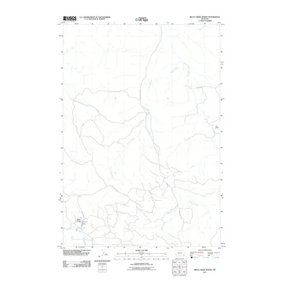
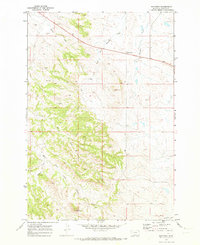
2011 Map of Belle Creek North
USGS Topo · Published 2011About this map
Belle Creek serves as the primary settlement hub in this part of Powder River County, Montana, situated near the western edge of the quadrangle. The landscape is defined by the drainage basins of the East Fork Little Powder River and Duncan Creek, which carve through the high plains. The map illustrates a local infrastructure of essential services and ranch access, including the Belle Creek Rural Fire Dist and a network of named thoroughfares such as Boyles South Rd and Bogner's Rd. The terrain is characterized by numerous draws and coulees, notably Ash Draw, and seasonal watercourses like Blowout Creek and Spring Creek. This 2011 survey captures the modern ranching and rural landscape of southeastern Montana, showing the continued importance of water access and fire protection in this sparsely populated territory.
Find a feature on this map
12 named features on this map. Tap any name to fly to it.
Don’t see what you’re looking for? This feature index may not catch every label — zoom into the map to look around manually.
Map Details
Editions of this 2011 Belle Creek North Map
This is the sole edition of this map. No revisions or reprints were ever made.
Other maps of this area

1954 · Ekalaka
USGS Topo · 1:250,000

1956 · Ekalaka
USGS Topo · 1:250,000

1958 · Ekalaka
USGS Topo · 1:250,000

1965 · Ekalaka
USGS Topo · 1:250,000

1970 · Sanburn Reservoir
USGS Topo · 1:24,000
1970 · Belle Creek North
USGS Topo · 1:24,000
1970 · Belle Creek South
USGS Topo · 1:24,000

1970 · Belle Creek SW
USGS Topo · 1:24,000
1970 · Stack Rocks
USGS Topo · 1:24,000
1970 · Hammond
USGS Topo · 1:24,000