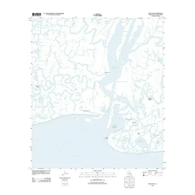
2012 Map of Belle Isle
USGS Topo · Published 2012About this map
Belle Isle stands as a prominent topographical feature in this coastal St. Mary Parish landscape, surrounded by a complex network of wetlands and tidal channels. The map documents the industrial footprint of the Belle Isle Gas and Oil Field at the southern edge of the state, where the land meets Atchafalaya Bay. The intricate hydrology is defined by major arteries like Wax Lake Pass and a dense web of smaller waterways, including Leopard Bayou, Bear Fork Bayou, and Hog Bayou.
Find a feature on this map
32 named features on this map. Tap any name to fly to it.
Don’t see what you’re looking for? This feature index may not catch every label — zoom into the map to look around manually.
Map Details
Editions of this 2012 Belle Isle Map
This is the sole edition of this map. No revisions or reprints were ever made.
Other maps of this area

1935 · Belle Isle
USGS Topo · 1:31,680

1937 · Bayou Sale
USGS Topo · 1:62,500

1941 · Belle Isle
USGS Topo · 1:62,500

1945 · New Orleans
USGS Topo · 1:250,000

1954 · Belle Isle
USGS Topo · 1:62,500

1957 · Bayou Sale
USGS Topo · 1:62,500

1957 · Point Au Fer
USGS Topo · 1:62,500

1963 · New Orleans
USGS Topo · 1:250,000

1966 · New Orleans
USGS Topo · 1:250,000
1966 · Lake Salve
USGS Topo · 1:24,000