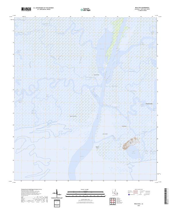
2024 Map of Belle Isle
USGS Topo · Published 2024About this map
Belle Isle rises from the marshy lowlands of St. Mary Parish, serving as a prominent landform in an environment dominated by shifting water and wetlands. This coastal landscape is defined by the heavy hydrologic influence of Wax Lake Outlet and the complex web of channels including New Pass, Coalboat Pass, and Wax Lake Pass. These waterways represent the active deltaic processes shaping the Louisiana coastline, where sediment-rich waters interact with the Gulf of Mexico.
Find a feature on this map
44 named features on this map. Tap any name to fly to it.
Don’t see what you’re looking for? This feature index may not catch every label — zoom into the map to look around manually.
Map Details
Editions of this 2024 Belle Isle Map
This is the sole edition of this map. No revisions or reprints were ever made.
Other maps of this area

1935 · Belle Isle
USGS Topo · 1:31,680

1937 · Bayou Sale
USGS Topo · 1:62,500

1941 · Belle Isle
USGS Topo · 1:62,500

1945 · New Orleans
USGS Topo · 1:250,000

1954 · Belle Isle
USGS Topo · 1:62,500

1957 · Bayou Sale
USGS Topo · 1:62,500

1957 · Point Au Fer
USGS Topo · 1:62,500

1963 · New Orleans
USGS Topo · 1:250,000

1966 · New Orleans
USGS Topo · 1:250,000
1966 · Lake Salve
USGS Topo · 1:24,000