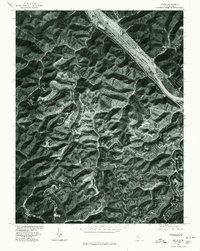
1977 Map of Belle
USGS Topo · Published 1980About this map
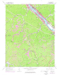
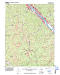
The Kanawha River valley serves as the primary corridor for industrial and residential development in this late-1970s orthophotographic study. Settlements including Belle, Marmet, and Chesapeake line the riverbanks, where the flat floodplain contrasts sharply with the dissected plateau of the surrounding West Virginia highlands. This orthophoto map provides a unique visual record of land use, showing the dense concentration of infrastructure along the water compared to the intricate network of ridgelines and hollows to the south. Further inland, smaller communities such as Winifrede and Comfort mark the intersections of narrow valleys, while the Big Coal River winds through the southwestern portion of the quadrangle. The imagery clearly delineates clearings and access roads that suggest the region's active timber and resource extraction industries during this era.
Find a feature on this map
9 named features on this map. Tap any name to fly to it.
Don’t see what you’re looking for? This feature index may not catch every label — zoom into the map to look around manually.
Map Details
Editions of this 1977 Belle Map
This is the sole edition of this map. No revisions or reprints were ever made.
Historical Maps of Marmet Through Time
8 maps found