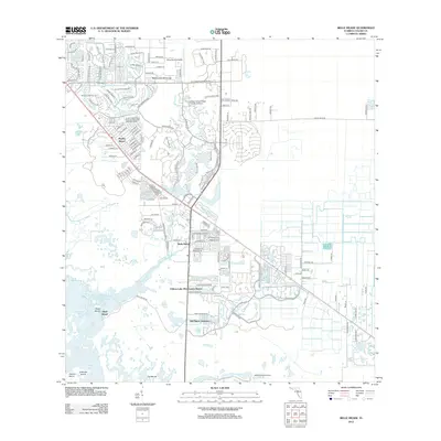
2012 Map of Belle Meade
USGS Topo · Published 2012About this map
Henderson Creek flows through the center of this coastal landscape, weaving together developed communities and preserved wetlands on the edge of the Everglades. The residential growth of Naples Manor and the academic presence of the Edison State College Collier Campus contrast with the surrounding natural features like Rattlesnake Hammock and the sprawling Rookery Bay. Local transportation and recreation are represented by the Marco Island Airport and the Mustang Golf Course, showing the modern infrastructure of this part of Florida. To the south, the terrain transitions into the coastal islands and bays, including Shell Island and Johnson Bay, while inland landmarks such as Old Marco Junction and the Pelican Lake Motorcoach Resort highlight the region's character as a destination for both transit and tourism.
Find a feature on this map
141 named features on this map. Tap any name to fly to it.
Don’t see what you’re looking for? This feature index may not catch every label — zoom into the map to look around manually.
Map Details
Editions of this 2012 Belle Meade Map
This is the sole edition of this map. No revisions or reprints were ever made.
Other maps of this area

1956 · Miami
USGS Topo · 1:250,000

1956 · West Palm Beach
USGS Topo · 1:250,000

1957 · West Palm Beach
USGS Topo · 1:250,000

1958 · West Palm Beach
USGS Topo · 1:250,000

1958 · Miami
USGS Topo · 1:250,000

1958 · Belle Meade
USGS Topo · 1:24,000

1958 · Naples South
USGS Topo · 1:24,000

1958 · Belle Meade NE
USGS Topo · 1:24,000

1958 · Belle Meade NW
USGS Topo · 1:24,000

1958 · Belle Meade SE
USGS Topo · 1:24,000