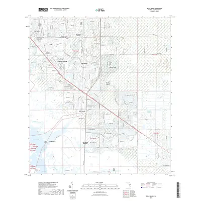
2021 Map of Belle Meade
USGS Topo · Published 2021About this map
Lely Resort and the residential core of Naples Manor define this coastal landscape on the edge of the Everglades, where rapid 21st-century development meets preserved wetland ecosystems. The map reveals a dense network of planned communities and golf courses established along the Tamiami Trl E corridor, contrasting sharply with the tidal waters of Rookery Bay and Hall Bay to the southwest. Religious and memorial sites are well-documented, including Saint Peter the Apostle Catholic Church and the Lely Presbyterian Church Cem.
Find a feature on this map
36 named features on this map. Tap any name to fly to it.
Don’t see what you’re looking for? This feature index may not catch every label — zoom into the map to look around manually.
Map Details
Editions of this 2021 Belle Meade Map
This is the sole edition of this map. No revisions or reprints were ever made.
Other maps of this area

1956 · Miami
USGS Topo · 1:250,000

1956 · West Palm Beach
USGS Topo · 1:250,000

1957 · West Palm Beach
USGS Topo · 1:250,000

1958 · West Palm Beach
USGS Topo · 1:250,000

1958 · Miami
USGS Topo · 1:250,000

1958 · Belle Meade
USGS Topo · 1:24,000

1958 · Naples South
USGS Topo · 1:24,000

1958 · Belle Meade NE
USGS Topo · 1:24,000

1958 · Belle Meade NW
USGS Topo · 1:24,000

1958 · Belle Meade SE
USGS Topo · 1:24,000