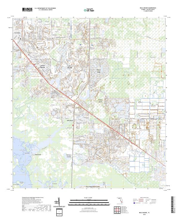
2024 Map of Belle Meade
USGS Topo · Published 2024About this map
Henderson Creek and its network of mangroves and wetlands define the southern landscape of this Collier County region, where the developed communities of East Naples and Lely Resort give way to the sprawling natural preserves of Rookery Bay and the Picayune Strand State Forest. The map documents a modern South Florida coastal environment characterized by planned residential developments like Verona Walk and Winding Cypress, contrasted with the labyrinthine tidal waters of Hall Bay and Whites River. Genealogists and local historians will find several burial sites noted, including the Saint Peter the Apostle Catholic Church Columbarium Cem and the Lutheran Church Memorial Cem. The transportation corridor is anchored by Tamiami Trail East, while more remote features like Old Marco Junction and the Marco Island Airport mark the transition toward the coastal islands.
Find a feature on this map
36 named features on this map. Tap any name to fly to it.
Don’t see what you’re looking for? This feature index may not catch every label — zoom into the map to look around manually.
Map Details
Editions of this 2024 Belle Meade Map
This is the sole edition of this map. No revisions or reprints were ever made.
Other maps of this area

1956 · Miami
USGS Topo · 1:250,000

1956 · West Palm Beach
USGS Topo · 1:250,000

1957 · West Palm Beach
USGS Topo · 1:250,000

1958 · West Palm Beach
USGS Topo · 1:250,000

1958 · Miami
USGS Topo · 1:250,000

1958 · Belle Meade
USGS Topo · 1:24,000

1958 · Naples South
USGS Topo · 1:24,000

1958 · Belle Meade NE
USGS Topo · 1:24,000

1958 · Belle Meade NW
USGS Topo · 1:24,000

1958 · Belle Meade SE
USGS Topo · 1:24,000