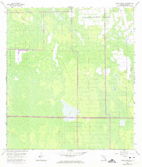
1958 Map of Belle Meade NE
USGS Topo · Published 1974About this map
Big Corkscrew Island and its smaller companion, Corkscrew Island, dominate the northern portion of this South Florida landscape, where the terrain is defined by cypress strands and vast wetlands. The most significant human intervention is the Everglades Parkway (Alligator Alley), which serves as a Toll Road cutting east-west through the marshy expanse. This survey, based on aerial photography from the early 1950s with photorevisions in the early 1970s, captures the region before extensive modern drainage projects and development altered the hydrology. Notable water features like Stumpy Strand and an isolated Camp reflect the sparse, seasonal human footprint in a territory primarily governed by the shifting water levels of the Big Cypress area.
Find a feature on this map
8 named features on this map. Tap any name to fly to it.
Don’t see what you’re looking for? This feature index may not catch every label — zoom into the map to look around manually.
Map Details
Editions of this 1958 Belle Meade NE Map
4 editions found
Other maps of this area

1956 · West Palm Beach
USGS Topo · 1:250,000

1957 · West Palm Beach
USGS Topo · 1:250,000

1958 · West Palm Beach
USGS Topo · 1:250,000

1958 · Corkscrew SE
USGS Topo · 1:24,000

1958 · Belle Meade
USGS Topo · 1:24,000

1958 · Catherine Island
USGS Topo · 1:24,000

1958 · Belle Meade NE
USGS Topo · 1:24,000

1958 · Belle Meade NW
USGS Topo · 1:24,000

1958 · Immokalee SW
USGS Topo · 1:24,000

1958 · Corkscrew SW
USGS Topo · 1:24,000