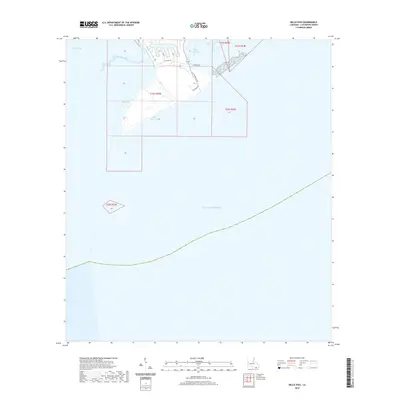
2020 Map of Belle Pass
USGS Topo · Published 2020About this map
Bayou Lafourche meets the Gulf of Mexico at the southernmost reaches of the Louisiana coast in this 2020 record of the evolving Mississippi Delta landscape. The map details the critical maritime and industrial corridors near the Gulf, where Belle Pass and Pass Fourchon provide vital deep-water access for the region's shipping and energy sectors. The transition from terrestrial bayou systems to open coastal waters is marked by landforms and man-made waterways like Evans Canal, alongside large expanses of water including Bay Marchand and Timbalier Bay. Coastal infrastructure is primarily focused along the bayou's edge, where local routes such as A O Rappelet Rd, Chevron Rd, and Lancon Rd connect industrial facilities and docks. This map documents a dynamic environment shaped by both tidal forces and the intensive infrastructure of the offshore oil and gas industry.
Find a feature on this map
29 named features on this map. Tap any name to fly to it.
Don’t see what you’re looking for? This feature index may not catch every label — zoom into the map to look around manually.
Map Details
Editions of this 2020 Belle Pass Map
This is the sole edition of this map. No revisions or reprints were ever made.
Other maps of this area

1892 · Cheniere Caminada
USGS Topo · 1:62,500

1894 · Timbalier
USGS Topo · 1:62,500

1935 · Pelican Pass
USGS Topo · 1:31,680

1935 · Calumet Island
USGS Topo · 1:31,680

1935 · Leeville
USGS Topo · 1:31,680

1945 · New Orleans
USGS Topo · 1:250,000

1945 · Leeville
USGS Topo · 1:31,680

1947 · Caminada Pass
USGS Topo · 1:31,680
1949 · Belle Pass
USGS Topo · 1:31,680
1953 · Belle Pass
USGS Topo · 1:24,000