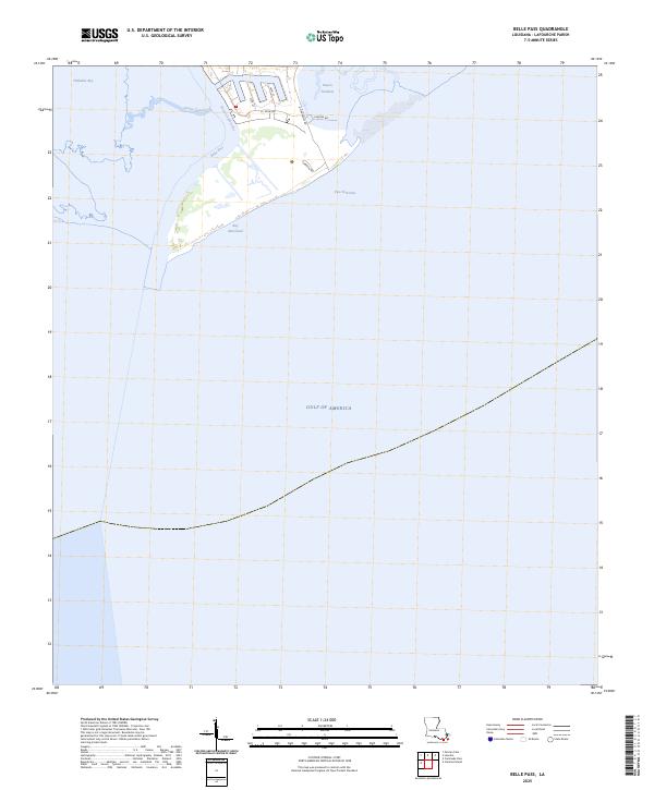
2025 Map of Belle Pass
USGS Topo · Published 2025About this map
Bayou Lafourche flows south through the marshlands of Lafourche Parish to meet the Gulf of America at Belle Pass, defining a landscape where industrial infrastructure and fragile coastal waterways collide. The 2025 survey illustrates the modern development at Pass Fourchon, where a network of localized roads such as A O Rappelet Rd, A J Estay Rd, and Chevron Rd support the maritime and energy sectors. This coastline is a complex of lagoons and channels, including Bay Marchand and Timbalier Bay, separated from the open sea by narrow, shifting spits of land. Navigational features like the Evans Canal and Bayou Tartellon cut through the wetlands, providing critical passage for vessels moving between the inland bayous and the deep gulf waters.
Find a feature on this map
14 named features on this map. Tap any name to fly to it.
Don’t see what you’re looking for? This feature index may not catch every label — zoom into the map to look around manually.
Map Details
Editions of this 2025 Belle Pass Map
This is the sole edition of this map. No revisions or reprints were ever made.
Other maps of this area

1892 · Cheniere Caminada
USGS Topo · 1:62,500

1894 · Timbalier
USGS Topo · 1:62,500

1935 · Pelican Pass
USGS Topo · 1:31,680

1935 · Calumet Island
USGS Topo · 1:31,680

1935 · Leeville
USGS Topo · 1:31,680

1945 · New Orleans
USGS Topo · 1:250,000

1945 · Leeville
USGS Topo · 1:31,680

1947 · Caminada Pass
USGS Topo · 1:31,680
1949 · Belle Pass
USGS Topo · 1:31,680
1953 · Belle Pass
USGS Topo · 1:24,000