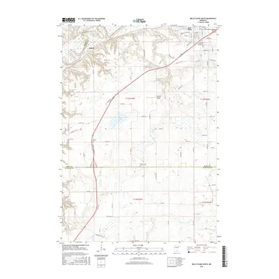
2016 Map of Belle Plaine South
USGS Topo · Published 2016About this map
Belle Plaine anchors the northeastern corner of this Scott County landscape, where the street grid transitions into the winding bluffs above the Minnesota River. The township roads, such as Belle Plaine Trl and Johnson Memorial Dr, follow the undulating terrain between the river valley and the flatter agricultural uplands to the south. This area is notably dense with small, localized burial grounds including Oakwood Cem, Sacred Heart Cem, and the Saints Peter and Paul Cem, suggesting long-established parish communities near the settlement of Blakeley.
Find a feature on this map
82 named features on this map. Tap any name to fly to it.
Don’t see what you’re looking for? This feature index may not catch every label — zoom into the map to look around manually.
Map Details
Editions of this 2016 Belle Plaine South Map
This is the sole edition of this map. No revisions or reprints were ever made.
Other maps of this area

1953 · Saint Paul
USGS Topo · 1:250,000

1957 · Belle Plaine
USGS Topo · 1:62,500

1957 · New Prague
USGS Topo · 1:62,500

1959 · Saint Paul
USGS Topo · 1:250,000

1965 · Le Sueur
USGS Topo · 1:24,000

1965 · St Thomas
USGS Topo · 1:24,000

1966 · Le Center
USGS Topo · 1:24,000
1981 · Jordan West
USGS Topo · 1:24,000
1981 · Hamburg
USGS Topo · 1:24,000
1981 · Belle Plaine South
USGS Topo · 1:24,000