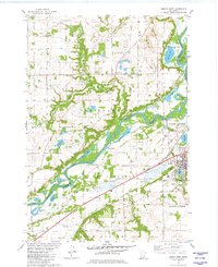
1981 Map of Jordan West
USGS Topo · Published 1982About this map
The Minnesota River carves a deep valley through this landscape, creating a series of wetlands and oxbow lakes such as Rapids Lake, Ahlswede Lake, and Horseshoe Lake. Along the bluffs, the transition from the river bottom to the upland plateau is marked by small settlements like East Union and St Lawrence. Local social and spiritual life centers on landmarks such as East Union Church and the Augustana Cemetery.
Find a feature on this map
52 named features on this map. Tap any name to fly to it.
Don’t see what you’re looking for? This feature index may not catch every label — zoom into the map to look around manually.
Map Details
Editions of this 1981 Jordan West Map
This is the sole edition of this map. No revisions or reprints were ever made.
Other maps of this area

1905 · Minnetonka
USGS Topo · 1:62,500

1907 · Minnetonka
USGS Topo · 1:62,500

1953 · Saint Paul
USGS Topo · 1:250,000

1957 · Belle Plaine
USGS Topo · 1:62,500

1957 · Waconia
USGS Topo · 1:62,500

1957 · New Prague
USGS Topo · 1:62,500

1958 · Victoria
USGS Topo · 1:24,000

1958 · Lake Minnetonka
USGS Topo · 1:62,500
1958 · Shakopee
USGS Topo · 1:24,000

1959 · Saint Paul
USGS Topo · 1:250,000