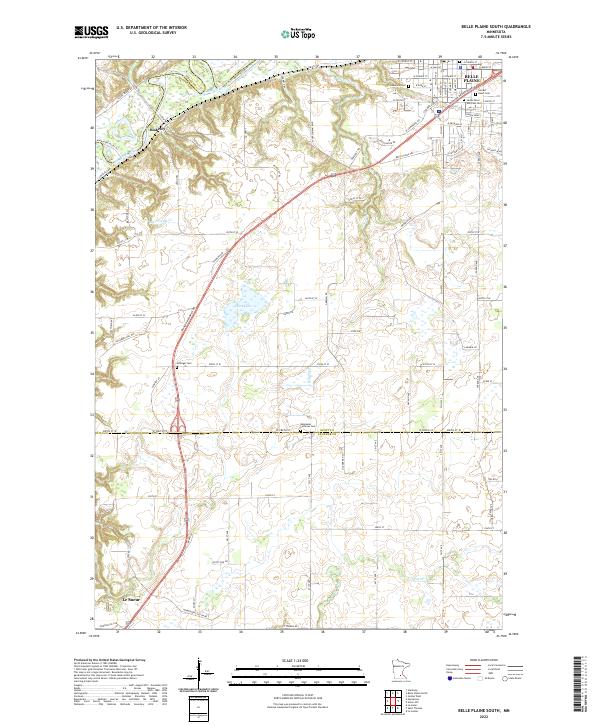
2022 Map of Belle Plaine South
USGS Topo · Published 2022About this map
Belle Plaine anchors the northeastern corner of this landscape, where the town site transitions from the valley floor toward the uplands. The Minnesota River snakes through the northwest, carving a distinct corridor that has long influenced the transportation patterns of Scott County and Le Sueur County. This contemporary survey reveals a well-ordered grid of rural roads, such as W 280th St, which serves as a boundary between the two counties.
Find a feature on this map
97 named features on this map. Tap any name to fly to it.
Don’t see what you’re looking for? This feature index may not catch every label — zoom into the map to look around manually.
Map Details
Editions of this 2022 Belle Plaine South Map
This is the sole edition of this map. No revisions or reprints were ever made.
Other maps of this area

1953 · Saint Paul
USGS Topo · 1:250,000

1957 · Belle Plaine
USGS Topo · 1:62,500

1957 · New Prague
USGS Topo · 1:62,500

1959 · Saint Paul
USGS Topo · 1:250,000

1965 · Le Sueur
USGS Topo · 1:24,000

1965 · St Thomas
USGS Topo · 1:24,000

1966 · Le Center
USGS Topo · 1:24,000
1981 · Jordan West
USGS Topo · 1:24,000
1981 · Hamburg
USGS Topo · 1:24,000
1981 · Belle Plaine South
USGS Topo · 1:24,000