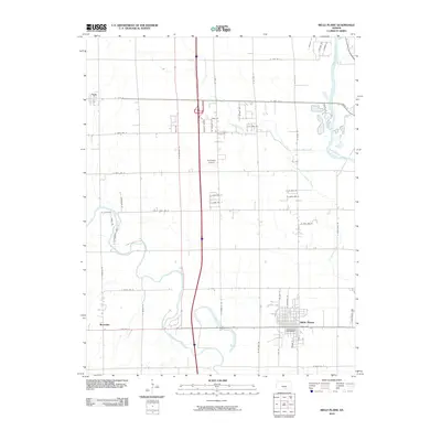
2010 Map of Belle Plaine
USGS Topo · Published 2010About this map
The Arkansas River and the Ninnescah River converge in this region south of Wichita, defining a landscape of riparian corridors and agricultural grid. Belle Plaine stands as the primary population center, where the Belle Plaine Post Office serves the local community. The town is situated just east of the Ninnescah River and north of its confluence with the Arkansas, illustrating a settlement pattern deeply tied to these major waterways.
Find a feature on this map
56 named features on this map. Tap any name to fly to it.
Don’t see what you’re looking for? This feature index may not catch every label — zoom into the map to look around manually.
Map Details
Editions of this 2010 Belle Plaine Map
This is the sole edition of this map. No revisions or reprints were ever made.
Other maps of this area

1889 · Wichita
USGS Topo · 1:125,000

1890 · Wellington
USGS Topo · 1:125,000

1894 · Wichita
USGS Topo · 1:125,000

1943 · Derby
USGS Topo · 1:31,680

1943 · Bayneville
USGS Topo · 1:31,680

1950 · Bayneville
USGS Topo · 1:24,000

1955 · Belle Plaine
USGS Topo · 1:24,000
1955 · Zyba
USGS Topo · 1:24,000

1955 · Rose Hill
USGS Topo · 1:24,000

1955 · Mulvane
USGS Topo · 1:24,000