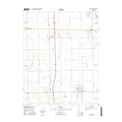
2015 Map of Belle Plaine
USGS Topo · Published 2015About this map
The Mulvane and Belle Plaine settlements anchor this 2015 study of the plains south of Wichita, where the Sedgwick and Sumner county line divides the landscape. The geography is defined by the convergence of several major waterways, most notably the broad Arkansas River winding through the eastern portion and the meandering path of the Ninnescah River further west. These rivers create a complex system of bends and cutoffs, such as the Cowskin Cr Cutoff, which significantly influenced local property lines and road placements.
Find a feature on this map
32 named features on this map. Tap any name to fly to it.
Don’t see what you’re looking for? This feature index may not catch every label — zoom into the map to look around manually.
Map Details
Editions of this 2015 Belle Plaine Map
This is the sole edition of this map. No revisions or reprints were ever made.
Other maps of this area

1889 · Wichita
USGS Topo · 1:125,000

1890 · Wellington
USGS Topo · 1:125,000

1894 · Wichita
USGS Topo · 1:125,000

1943 · Derby
USGS Topo · 1:31,680

1943 · Bayneville
USGS Topo · 1:31,680

1950 · Bayneville
USGS Topo · 1:24,000

1955 · Belle Plaine
USGS Topo · 1:24,000
1955 · Zyba
USGS Topo · 1:24,000

1955 · Rose Hill
USGS Topo · 1:24,000

1955 · Mulvane
USGS Topo · 1:24,000