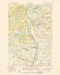
1950 Map of Belle Prairie
USGS Topo · Published 1950About this map
The Mississippi River divides the landscape of this 1950 survey, where the river's path is punctuated by numerous named islands such as Topeka Islands and Roscoe Island. This era captures the post-war footprint of the Fort Ripley Military Reservation, positioned near the historic settlement of Fort Ripley. To the west, the Northern Pacific railroad corridor anchors small communities and agricultural hubs like Darling Switch and Randall, tracing a vital transportation link through Morrison County.
Find a feature on this map
117 named features on this map. Tap any name to fly to it.
Don’t see what you’re looking for? This feature index may not catch every label — zoom into the map to look around manually.
Map Details
Editions of this 1950 Belle Prairie Map
2 editions found

Other maps of this area

1915 · Brainerd
USGS Topo · 1:62,500

1916 · Pillager
USGS Topo · 1:62,500

1918 · Brainerd
USGS Topo · 1:62,500

1919 · Pillager
USGS Topo · 1:62,500

1947 · Flensburg
USGS Topo · 1:25,000

1948 · Belle Prairie
USGS Topo · 1:62,500

1948 · Pierz
USGS Topo · 1:62,500

1948 · Lastrup
USGS Topo · 1:62,500

1948 · Cushing
USGS Topo · 1:62,500

1948 · Little Falls
USGS Topo · 1:62,500