
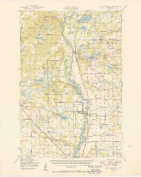
1950 Map of Belle Prairie
USGS Topo · Published 1950About this map
Camp Ripley Military Reservation dominates the central river valley on this mid-century survey, spanning the transition between the Mississippi River and the lake-studded prairie. The landscape is defined by its military and agricultural history, with the historic Fort Ripley located just north of the active installation. To the east, the Nakasippi River and Crow Wing River wind through a series of townships including St Mathias and Belle Prairie, where numerous local schoolhouses and town halls serve the farming community.
Find a feature on this map
116 named features on this map. Tap any name to fly to it.
Don’t see what you’re looking for? This feature index may not catch every label — zoom into the map to look around manually.
Map Details
Editions of this 1950 Belle Prairie Map
2 editions found
Other maps of this area

1915 · Brainerd
USGS Topo · 1:62,500

1916 · Pillager
USGS Topo · 1:62,500

1918 · Brainerd
USGS Topo · 1:62,500

1919 · Pillager
USGS Topo · 1:62,500

1947 · Flensburg
USGS Topo · 1:25,000

1948 · Belle Prairie
USGS Topo · 1:62,500

1948 · Pierz
USGS Topo · 1:62,500

1948 · Lastrup
USGS Topo · 1:62,500

1948 · Cushing
USGS Topo · 1:62,500

1948 · Little Falls
USGS Topo · 1:62,500